Revealing Lake Ohrid’s hidden underwater archaeological heritage (down to 8000 years old!)
Help us uncover and protect Lake Ohrid’s hidden underwater past before it is lost! Support our field campaign to map, date, and document this unique heritage for future generations.

The town of Struga at the northern shore of Lake Ohrid 
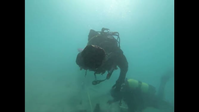
Underwater excavations at Vrbnik, about 700 meters from Struga. 

An Iron Age ceramic vessel from underwater excavations 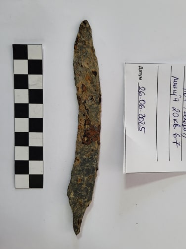
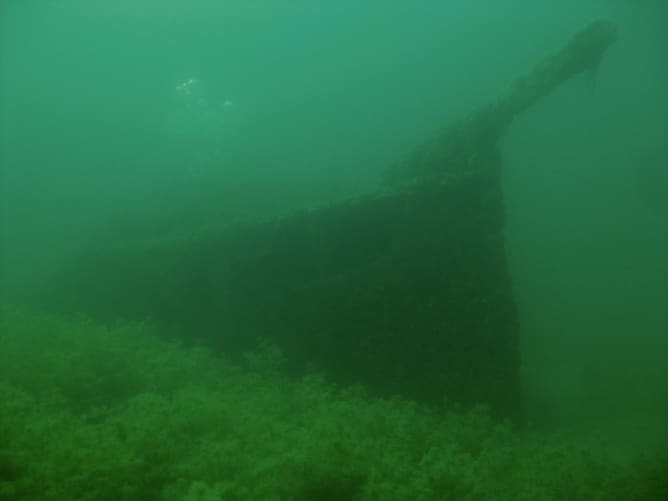
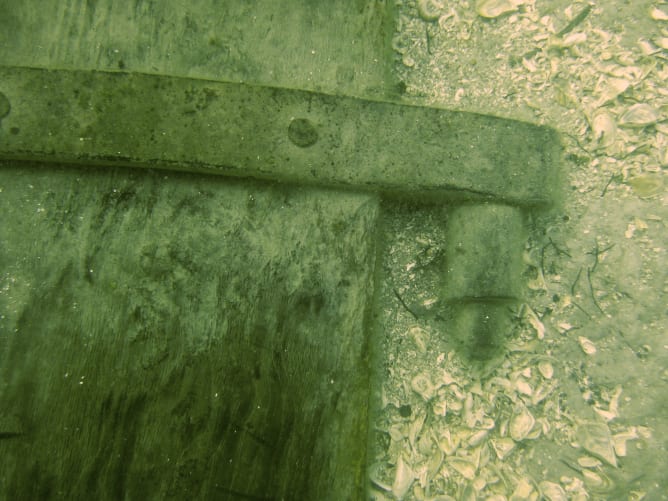
A shipwreck from near Struga
Why Lake Ohrid’s underwater heritage matters
Lake Ohrid is one of the oldest lakes in the world, formed over 1.36 million years ago. It is not only the most biodiverse lake globally, but also home to some of Europe’s oldest lakeshore settlements, dating to around 5800-5500 BC.
While its geology is well studied, much less is known about its archaeology. Only a few underwater sites have been explored, and along the northern shore, just one site has been documented (Vrbnik, ca. 600 BC). Many more remain undetected and unprotected, including a fleet of shipwrecks near Struga. Underwater sites erode slowly over time naturally, but the ever-growing human pressure on the lake increases the risks for disappearance of these site.
What makes Lake Ohrid underwater sites exceptional is their preservation. In low-oxygen conditions at the lakebed, organic materials such as wood or seeds, can survive for thousands of years. This allows us to date archaeological remains with high precision using dendrochronology and radiocarbon, combined with the unprecedented preservation compared to dryland sites where most organic material is decomposed. The superb preservation of wood besides enabling high-precision dating, also enables high resolution climate reconstruction from tree-rings. This allows for a unique multidisciplinary approach for understanding the past.
During our field campaign, we will systematically map shipwrecks, document fragile prehistoric structures, and record key information along the northern shore. This will generate new insights into the region’s past and create lasting digital records.
As an international team of enthusiastic archaeological divers from Macedonia, Switzerland and Germany, we aim not only to investigate the past, but to protect by increasing public awareness. By creating lasting records and sharing our findings, we help safeguard this heritage for future generations and bring it closer to the public.
Photo credits: Team members, EXPLO Project (exploproject.org), Museum Struga (museumstruga.mk), National Archaeological Museum (amm.org.mk), Klub Norkac

Samples from wooden piles 2600 years old! These are remains from prehistoric structures at Vrbnik, eroded due to age and natural and human caused erosion. 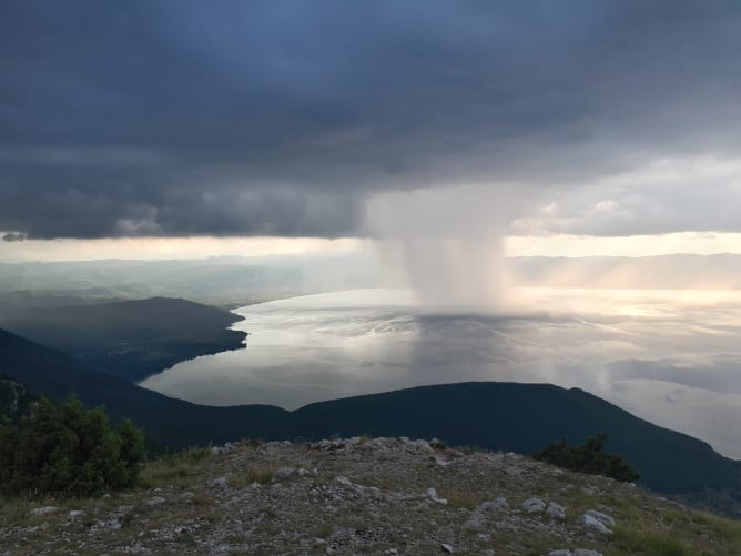
Magnificent rain shaft over Lake Ohrid 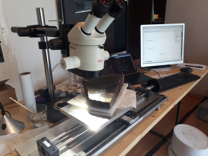
The tree-rings of a wood sample being measured under the microscope for dating via dendrochronology. 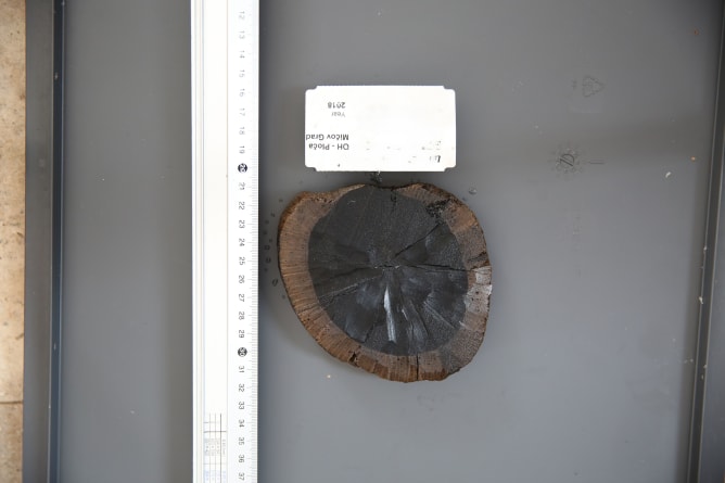
A slice of prehistoric wood 3300 years-old from Lake Ohrid that has been dated via dendrochronology and radiocarbon. 
Samples for radiocarbon dating. A great way to know how old something is but it's also pricey! 
What your support makes possible:
- 14 days of fieldwork: boat and equipment rental, fuel, travel, diving logistics, scientific equipment
- Radiocarbon and dendrochronological dating, and other scientific analyses
- Archaeological documentation and evaluation: recording key features, sampling for settlement history, high resolution 3D mapping of the shipwrecks and sites at risk, drone supported shoreline mapping, local collaboration
- Data processing and digital archiving: software, storage, and post processing for 3D models
- Collaboration with local divers and museums
-
Outreach activities and conservation: creating open-access online visualizations and information, and public presentations; advocating for official protection of underwater sites
-> Going beyond our goal will allow us for longer fieldwork, potentially more sites, a community workshop, and more and better dating and understanding of the priceless underwater heritage!

Diving equipment needs to be rented locally as many elements are heavy. 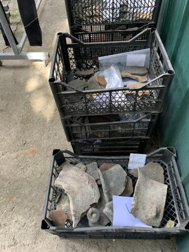
Numerous archaeological finds such as pottery and iron tools need to be cleaned, documented, and deposited in a museum. 
What remains underwater from something that was once a settlement! 
Bleached tree rings ready for radiocarbon (14C) dating. 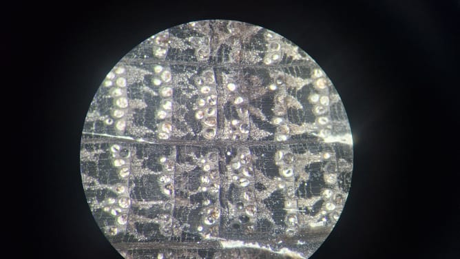
Oak tree rings under the microscope (from a wooden pile ca. 2600 years old). Each row of large white «dots» represents the earlywood which is the beginning of a tree ring. Measuring the distances between tree rings and matching their patterns for dating is part of the discipline of dendrochronology. 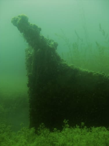
A shipwreck from near Struga